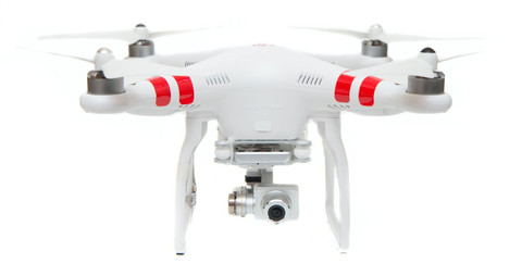
However, in recent years, aerial photography has witnessed dramatic changes, and has been taken to amazing heights, with the advent of little flying machines called drones, which do not require pilots or fuels to operate. Already kicking into warp speed, drones are nothing but small-sized unmanned flying vehicles that operate either autonomously by on-board computers or by a remote control on the ground.
With high-end and sophisticatedly designed drones, aerial photography is reaching superb heights. Owing to their ease of use, and the capacity to capture breathtaking images and videos, drones are gaining new and innovative applications in a number of industries. Unique civilian uses are emerging for the unmanned aerial system, some of the most reputed ones being military and intelligence applications such as targeted assassinations and aerial surveillance.
While today, it is only the government agencies and a few public universities and private companies who hold FAA permits to fly private
drone camera helicopters, the Federal Aviation Administration is all set to allow more commercial drones to fly in the sky. Around 7,500 small machines resembling model airplanes are expected to fly in the air by 2020. So what exactly these drones are expected to do? Here is a list of significant civilian areas where these unmanned aerial vehicles are already functioning with utmost efficiency:
- Hurricane Hunt: Superiorly designed and built drones, with a capacity to fly for as long as 30 hours and cover a distance of around 11,000 miles, can charge into the heart of a storm, chasing them without putting into risk human life. The unmanned aerial system is perfectly capable of reaching and staying in stormy areas, performing meticulous surveillance, which cannot be expected from manned flying devices.
- 3-D Mapping: Even when they resemble simple model airplanes by look, small-sized drones can efficiently survey landscapes and capture innumerable images, which can be stitched together to form 3-D maps. While in present times, drone camera helicopters are mainly used by military and other government satellites to develop 3-D maps, it is expected that the emerging UAV technology is going to expand the scopes, allowing even small companies and individuals to produce such maps for a wide variety of purposes. Advanced technologies are going to make drones even more convenient to use, eliminating the need to use even a remote control. They would be guided by GPS and would be highly safe.
- Wildlife Protection: Drones are already in use for protecting lands that are owned by the government, and the species occupying them. However, new advancements are in progress to revolutionize the use of the unmanned aerial system for better surveillance of wildlife population, mapping roads and also for land management purposes.
New and innovative applications of high-end drones are gaining popularity in present times. When the most appropriate drone camera helicopter is used, the device can efficiently serve innumerable purposes such as fire scene inspections, monitoring catastrophes, search and rescue, counting animal population, mapping of sandbank movements, road accident analysis, monitoring nuclear accidents, power cable inspection and many more.
With a drone, aerial photography is all set to move to a completely different level. However, one of the important things that need to be made sure is that the right device is used for each specific purpose.
 Julia
Julia